Map Settings
The Map page of the Settings dialog box lets you specify how information is displayed in the map.
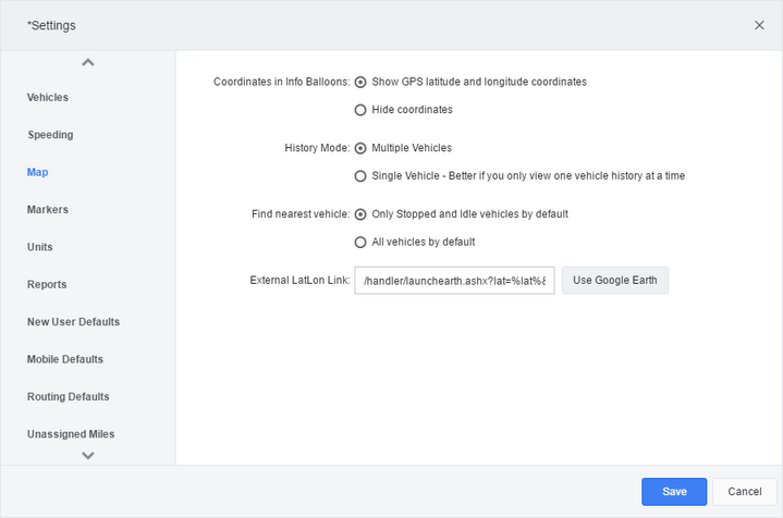
Coordinates in Info Balloons: |
Indicate if info balloons include the latitude and longitude of the vehicle’s position. |
History Mode: |
If your version of this product allows multi-histories, specify how you want vehicle histories presented. If you currently have the map as one of your screen tabs, you must click the "X" on the tab to close it before this change can take effect. |
Find Nearest Vehicle: |
Choose Only Stopped and Idle vehicles by default if you want the Find Nearest Vehicle pop-up to limit its search to vehicles that are not currently moving. Choose All vehicles by default if you want to see moving vehicles as well. |
Map Style: |
If your version allows additional layers to be added to the map to provide extra information, choose what information you want included in the map. |
External LatLon Link: |
Specify a URL that launches when you select Go To Link after you click a latitude and longitude value on the map screen. In the URL, use the strings “%lat%” and “%lon%” as placeholders for the actual latitude and longitude. Note that for this link to work, you may need to enable prompting for file downloads. This feature is not available in all versions. |
 Previous
 Next
Next Expand/Collapse
 Print
Print Share Page
 Training
 Knowledge